 Land Mapper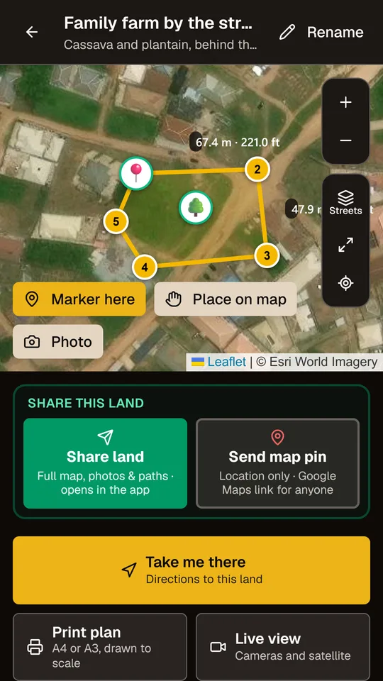
Measure by walking
Stand on each corner and tap Capture. Get the area in square metres, hectares, acres and plots, and every side in metres and feet.
Land Mapper turns your phone into a land-measuring tool. Walk to each corner, and it draws the boundary, works out the size, prints a plan to scale and guides you back to it, even where there is no internet.
Free to start. No ads.
Built for the field: big buttons, clear GPS signal, and everything saved on your phone first.
Stand on each corner and tap Capture. Get the area in square metres, hectares, acres and plots, and every side in metres and feet.
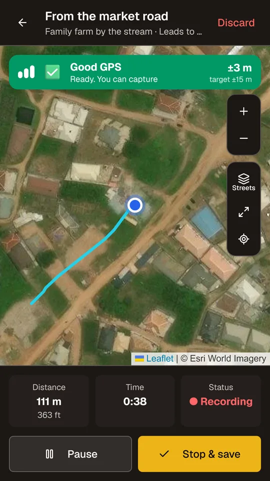
“Take me there” guides you to your land. Record the footpath that no map shows, then follow it again or share it.
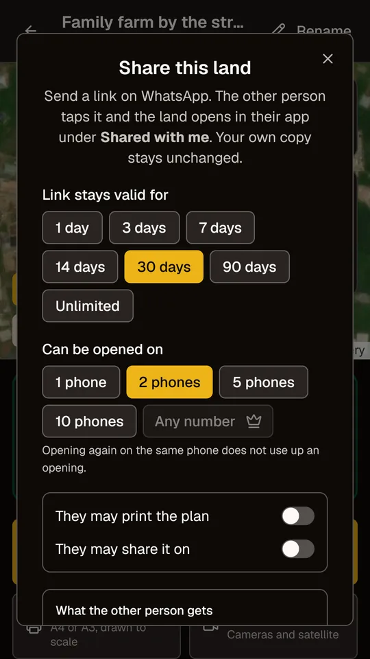
Send a land by link on WhatsApp. You choose how long it lasts and on how many phones it opens, and you can withdraw it at any time.
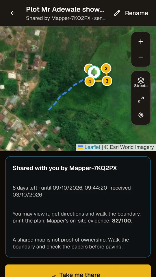
A land sent to you opens with its outline, markers and the path to it, plus the mapper’s on-site evidence score. Walk it before you pay.
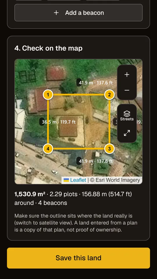
Type or paste the beacon coordinates from a surveyor’s plan (UTM, latitude/longitude or Nigeria’s Minna grid) and check them on the satellite map.
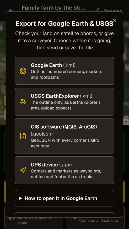
Print a clean plan to scale on A4 or A3. Export for Google Earth, USGS EarthExplorer, GIS software and GPS devices.
No training and no equipment. Just your phone and a walk around the land.
Go to each corner, wait for the green GPS signal, and tap Capture. The app averages many readings for each corner.
The boundary appears on the map with its size and side lengths. Add markers like trees, wells or beacons, and photos.
Your land is saved on your phone. Print the plan, record the way there, or send it to family, a buyer or a surveyor.
Start free. Upgrade when you need more. Prices are shown in your own currency on Google Play, and you can cancel at any time.
A phone’s GPS is usually accurate to about 3 to 5 metres in open sky. The app shows the accuracy of every corner and waits for a good signal. A licensed surveyor with survey equipment is accurate to centimetres.
Yes. Mapping, measuring and printing work offline. Maps you have viewed before stay available, and anything that needs internet waits on your phone and goes by itself later.
Everywhere. GPS works worldwide, the app shows area in square metres, hectares and acres (and in plots where land is sold in plots), and survey plans can be entered in UTM or latitude/longitude, with Nigeria’s Minna grid built in.
Your lands are kept on your phone, with backups you can save. Lands you published or shared are also kept online: contact us with your Mapper ID (Help → My ID in the app) and we can send them to your new phone.
Only you, unless you share a land or publish it. Published lands show other mappers only an outline and your anonymous Mapper ID, so that people buying nearby can see the land is already mapped.
In the app, go to Settings → Delete my online data. Or see how to delete your account.